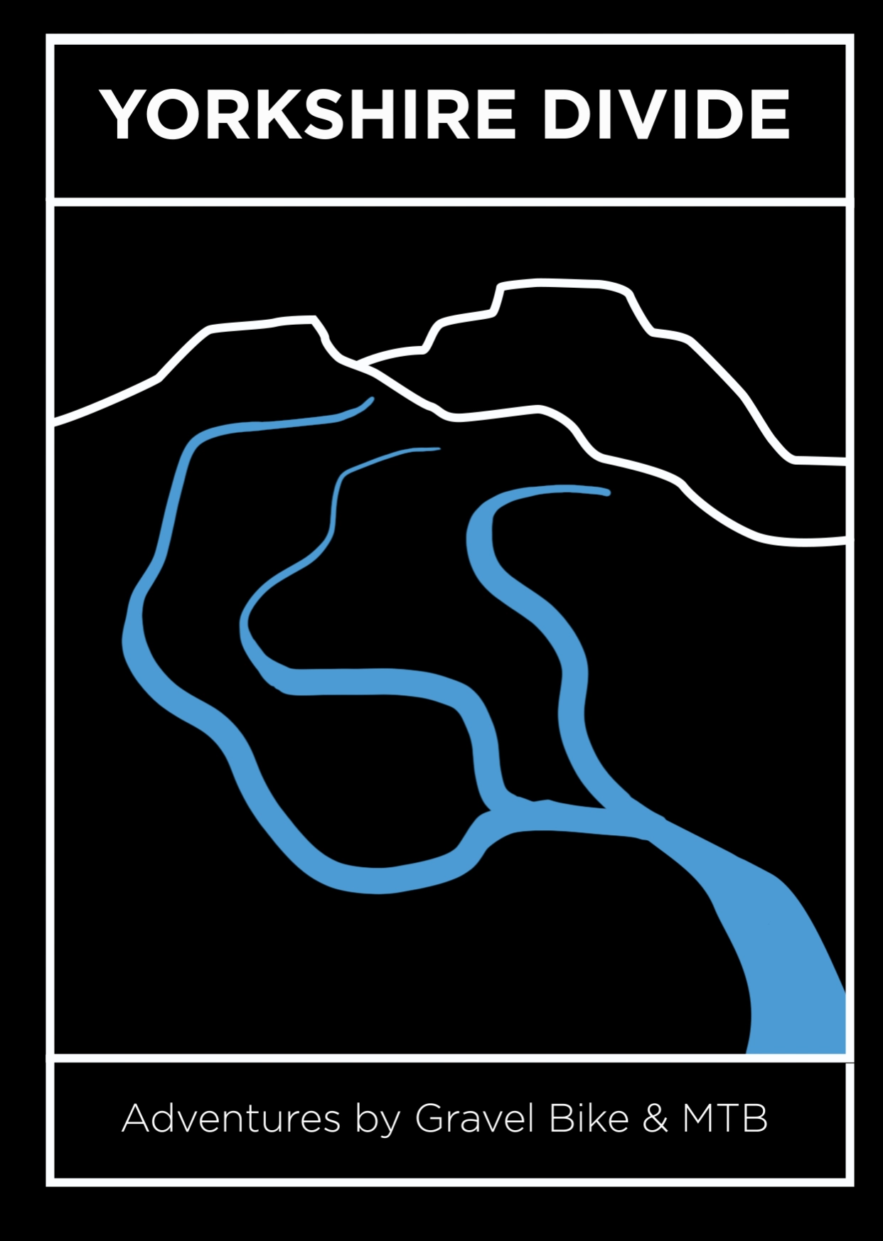
Source to Sea Trail
850kms / 11,500 meters
Saturday 25th May to
Thursday 30th May, 2024
Entry fee: £50
Maximum of 50 riders
50% of proceeds donated to ForUs Tree
There is an option of a 700km route.
Map: source to sea trail
NB: There is a shortcut on the Source to Sea Trail that goes due south from Selby towards Castleford and then west to Hebden Bridge. This misses out the eastwards loop that takes riders over the Humber Bridge but you do get to go over the equally impressive Millennium Bridge in Castleford. This option makes the trail around 700kms.

Contact:
Adrian Wright
yorkshiredivide@gmail.com
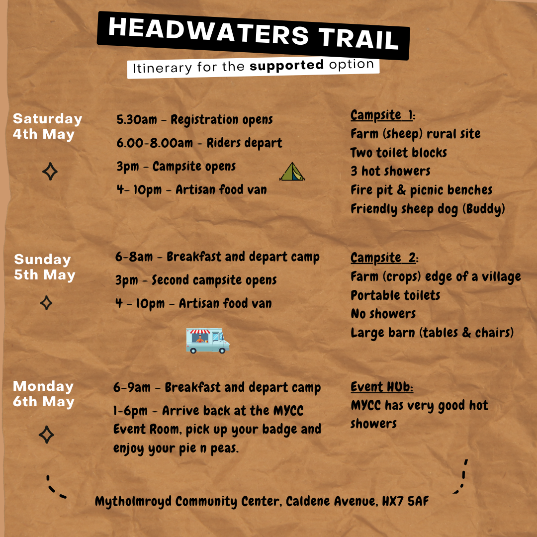
Map: headwaters trail


Key points
Are these races?
The two events are NOT races. They are intended as a personal challenge but times will be recorded and noted on your certificate and on the website (or not if a rider chooses).
Why use GPS trackers?
Live GPS trackers are amazing technology as they allow friends, family and of course Event Officials to see your progress and watch the event unfold in real time on a phone, laptop or TV screen. But they come at a high cost of approximately £40 per unit (once event support and postage are factored in). On the Headwaters Trail we will use GPS trackers provided by ‘FOLLOW MY CHALLENGE’. On the Source to Sea Trail we will be using TRACK LEADERS so that riders can upload their personal GPS units.
Event Room
HQ on the Headwaters Trail is Mytholmroyd Community Centre, Caldene Avenue, HX7 5AF with its easy access to the bike trails, excellent facilities, proximity to the train station and ample free car / van parking. The starting line will be at the front of the community center.
The starting line for the Source to Sea Trail is the canal marina in the center of Hebden Bridge. Details on the Source to Sea page.

What 3 Words location for the Headwaters Trail event: mend.relatives.warthog
Can I enter on the day of the event?
No ‘on the day’ entries.
What type of bike can I enter with?
Both of the routes cover a variety of terrain including cobbles, grass, peat, grit stone, gravel that is smooth, gravel that is loose, gravel full of potholes, concrete track ways, stone slabs, tarmac and everything in between! We recommend tyres of 40mm upwards and any of the following bikes will get you around the routes: Gravel bike / Cyclocross bike / Mountain bike / Fat bike if that is your thing. The terrain is not suitable for road bikes.
Who gets to enter?
Bike events should reflect the wider society from which they grow and therefore we welcome entry from all individuals. We will adopt the practice we use on the Calder Divide Trail event of having a camping field on the Headwaters Trail event for the Saturday and Sunday night set aside for women, trans, non-binary if a rider wants to choose that option.
Are the routes signposted?
There is no signage saying ‘Yorkshire Divide’ out on the hills, moors and valleys. The routes on both events are on bridleways, Sustrans greenways along the urban fringe, open access moorland, restricted-by ways, sections of the ace Pennine Bridleway, the Trans Pennine Trail and minor public roads. A GPX file for the event you have entered will be sent to your email address two weeks prior to the event.
Are there feed stations?
There are no feed stations on the trail. But you’re not riding in the wilderness. There are cafes, shops and pubs at regular points along both trails. It is your responsibility to plan ahead and take on adequate levels of hydration and nutrition throughout the course of the event you have chosen to participate in.
What is the minimal kit I need to carry?
Wear a helmet that complies with the latest EN1078, ANSI Z90/4 or SNELL standards. Waterproof clothes including full length trousers and jacket. Warm layers for changing into stored in a dry bag. An emergency thermal bag. Front and rear lights.
Will I get a record of my time?
The Headwaters Trail event is intended as a personal challenge and not a race and so we will NOT record your start / finish time. There will of course be a FKT by a female and male rider and we will use Strava times to set and publish these records.
On the Source to Sea event we will use the time recorded on the TRACK LEADERS GPS ‘dot watching’ web page created as you start from and return to the finish line in Hebden Bridge. This is a ‘single stage event’ where the clock starts when a rider crosses the start line and only stops when they return to the finish line.
If a ride on the Source to Sea opts to NOT use a tracker that’s fine. They can of course still submit a time for the record book via Strava.
Is there a minimum age?
On the ‘Headwaters Trail’ there is a minimum entry age of 14 years old when accompanied by an adult. The ‘Source to Sea Trail’ has a minimum entry age of 18.
Is there car/van parking at the start/finish line?
At Mytholmroyd Community Center there is space for 100 vehicles on a first come-first served basis with a donation box. There is additional secure parking at Mytholmroyd train station. There is a very good cycle path from Mytholmroyd into Hebden Bridge.
Do I need insurance?
You will need your own insurance. Being insured through either British Cycling or Cycling UK would help cover you. This is for your personal liability. You will need to add additional insurance for bike or injury.
What information will I receive once I sign onto the event?
Once a rider signs onto the event they will receive a total of four shots of info. The first at the signing on stage with an email which gives you your rider number, a second on the day of the entry deadline, the third shot is the all important gpx file sent to you two weeks before the event and the final email a week after the event giving a summary of riders achievements and experiences.
What happens if the route changes?
The organisers reserve the right to adjust the routes ahead of the day to account for unforeseen conditions (e.g., flooding, landslips, angry farmers) but if it does it will notify all participants who have signed up by that point of the changes.
pre-event camping options
OLD CHAMBER FARM AND CAMPING
Old Chamber Farm, Hebden Bridge, HX7 6JG
The campsite is on a working farm with basic facilities such as shower / toilets / barn.
Contact Ann Jones directly to book a pitch (£12). Details below.
Email: oldchamber.aj@gmail.com
Ann: 07814321606
Travel to the Old Chamber campsite:
The road up to us is a single-track road with passing places. You must follow the directions set out below. Do not follow your sat nav or google maps to get to us as it will take you up tracks that you wish you’d never been!!
Old Chamber Farm
Erringden
Hebden Bridge
West Yorkshire
1. From the Co-op on Market Street in the center of Hebden Bridge turn onto the side road called Hebble End
2. Take the left fork onto Shelf Road to head uphill crossing a bridge that takes you over the main railway line
3. Keep going past the houses on what is now 'Palace House Road' until you reach the end
4. Take the concrete road named Wood top and follow it all the way up the steep hillside, going very slow over the little rough bit.
5. Take Spencer Lane which is a very very steep cobbled lane straight in front.
6. Turn right at the top passing a building with a big stone arch.
7. Our house is the very last property and the camping is just past it.
On arriving at the farm phone Ann or knock on her farmhouse door and she will show you where to pitch up / park on the field.
HEBDEN CAMPING, NEW DELIGHT INN
The New Delight Inn, Colden, HX7 7HT
07763 574069
RIDGE FOLD CAMPING
Packhorse Inn, Widdop Road, HX7 7AT
07989 322617
‘Pop-up’ campsite open in the summer.