where it all started
The bike adventures under the heading of the Yorkshire Divide grew out of a promise I made to a friend to ‘do a big ride’ and a chance discovery of a map of the British Isles that changed how I saw the landscape around me.

calder divide trail
The Calder Divide Trail was the first long distance bikepacking route that I created as a tribute to the memory of local rider Will Norman who was part of a mountain bike group called ‘Bike Club’ that has been riding trails in the Calder Valley for over 20 years. Tragically Will died in 2021 from cancer. He was 42 years old.
The photo below shows Will (on the left), enjoying a Bike Club ride in the hills above Hebden Bridge. Will is the rider with the big smile. He always had that smile. He always had time for a chat. He always looked forward to the next ‘big ride’ out on the moors.

bike club
Will joined Bike Club after his partner Liz approached me in the Big 6, a pub in my home town of Halifax, and asked if other riders could join the group. Liz was with her fell running group whilst Will was stuck at work so I took Will’s name and email address.
Later that week I got in touch with Will and we chatted about biking and our need to explore the outdoors.
The next week Will joined our Wednesday night ride and then he became a regular, riding through the summer months and into winter just as we’d done for the last 20 years. Will’s job as a teacher took up a lot of his time but he also managed to get out on Saturday rides and joined the Bike Club awards night out.
Will was a quiet, gentle bloke. 6 foot 2 and strong on his bike. He rode with Bike Club for 5 years but then suddenly he stopped coming.
I assumed his school work was consuming all of his time but then I ran into Liz in the local park and she told me that Will had pancreatic cancer.

The Piece Hall
When I meet up with Will for the last time he was with Liz and their two young children in the Piece Hall in Halifax. It was between the various Covid lock downs and everyone was out.
On that day I was in a record / coffee shop called Loafers and Will was sat outside enjoying the sun. We got talking. Liz looked at Will and said “You need to tell him”.
I knew what was coming next. Will laughed but Liz pressed on. “He doesn’t have much longer” she said. There wasn’t much we could say. So we just sat beneath the old sandstone columns and watched the children run around.
Eventually I got up, shook his hands and said “Bike Club have been asking after you and we’ve kept your spot in the Big 6”.
He smiled at hearing the news. I parted with a nod and the words “We’ll do a ride for you”. I didn’t see him again.
Will’s funeral was online. We lost a riding buddy. His partner Liz lost a friend and a husband. Their two children lost a father.

A new landscape
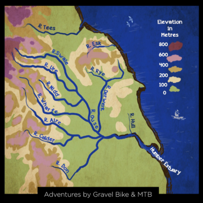
My promise to Will of ‘doing a ride’ stuck in my mind and by chance a few days later I saw a new map of the British Isles created by Robert Szucs.
On this map of the British Isles (shown below) every river basin is represented by a different colour and within each basin the thickness of the lines represent the volume of water. Szucs map opened my eyes to a trail that I hadn’t seen before.

For many years I had explored parts of the watershed of the Calder - the high ground where the river begins its life. Szucs’ digital map helped me see the whole watershed of the River Calder that extends from the moors above Todmorden on the Lancashire/Yorkshire border down to Castleford where the River Calder meets the River Aire. Along the way the Calder is joined by six other rivers – the Cragg, Hebble, Ryburn, Colne, Holme and Spen – and covers just under 400 square miles.
So I set out to explore the network of bridleways, green lanes and singletrack that were there, on strips of common land, created by local people over the last 6,000 years, from the Pennine moors such as Flower Scar where the river gathers, on through steep sided wooded valleys such as Coxley, past the high ground of Thieveley Pike and under the white blades of numerous wind farms.
I found that the trails connected into a circular route that traced the watershed of the River Calder. I called it the Calder Divide Trail.
the event
Six months after Will had passed Liz got a real surprise when I turned up at her house with the Calder Divide idea. It threw her at first. She was busy raising two children. She had a full time job. But she was a fell runner and loved the hills just like Will did and inside 5 minutes we were recalling stories of Will and his bike adventures. She gave her blessing to the ‘big ride’ and the event and so I got on with the planning.
The Calder Divide Trail event has been set up with two aims. Firstly to celebrate the beauty of the trails we have here in West Yorkshire. Secondly to raise enough money to fund one day in the life of Overgate Hospice.
The daily running costs of the hospice with its dedicated team of nurses, doctors and therapists is in the order of £2,000 a day. The target is therefore to raise £2,000 and so make a ‘Will Norman day’.

one divide, many trails
In the moment I saw the outline of the Calder Divide Trail I also knew there were other trails out there on the heather clad moors that encompass the wider Humber basin into which the 25 main rivers flow.
I have now mapped out the Headwaters Trail, a circular route around the high ground of the River Calder, River Aire and River Calder and the Dales Trail which explores the finest tracks and lanes around the border of the Yorkshire Dales National Park and Nidderdale.
On a grander scale, as it takes in the whole of the Humber basin it which Yorkshire sits, is the Source to Sea Trail. This 730km circular route connects trails on the high ground where 10 rivers rise: Swale, Ure, Wharfe, Nidd, Esk, Derwent, Ouse, Humber, Don and Calder.
I think this way of keeping a promise and seeing the rivers and the landscape they shape is worthy of the words ‘divide’ and ‘trail’. I hope you do to.
Adrian Wright
January 25th 2022

Scarborough, October 2022
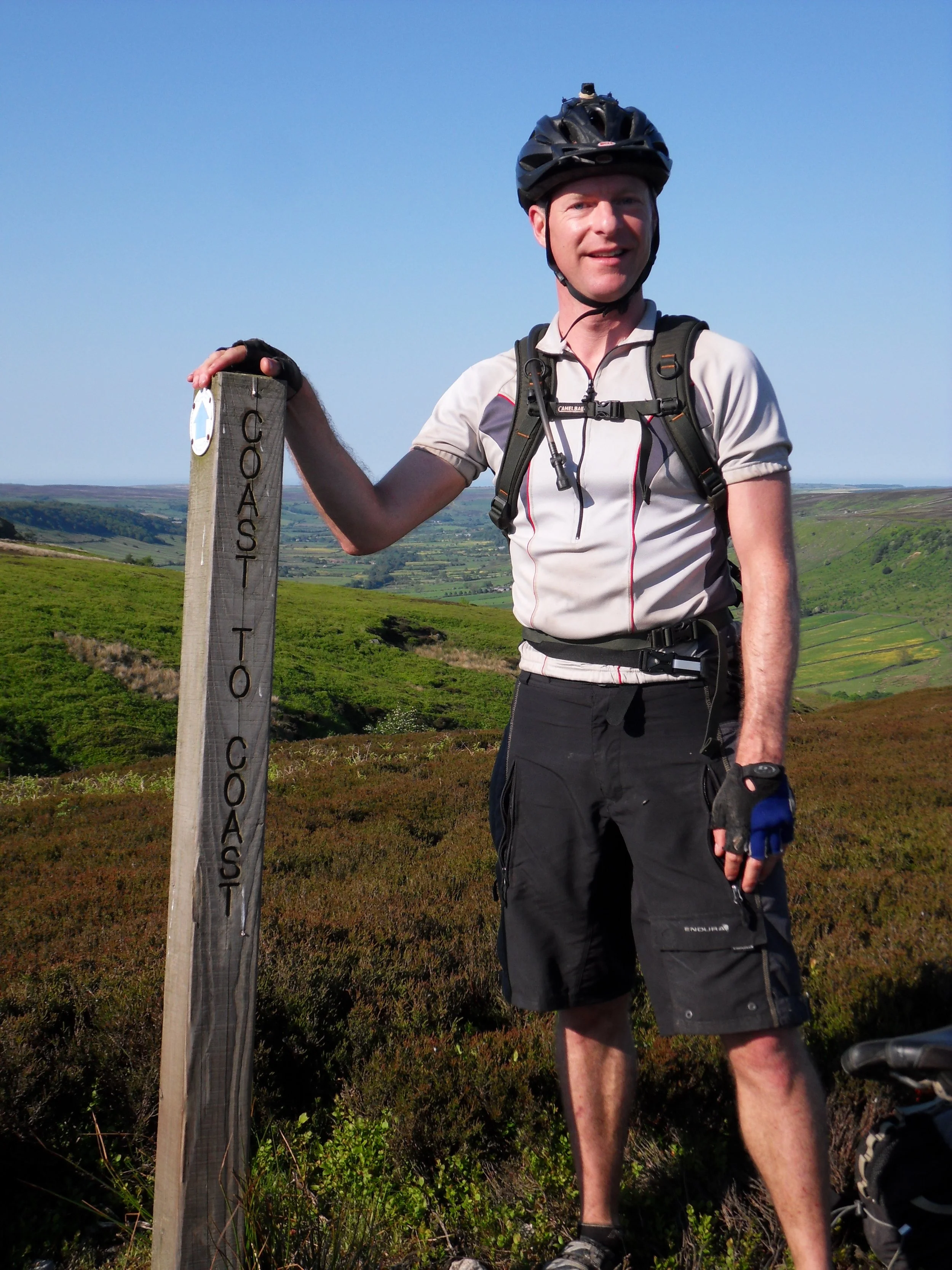
Coast to Coast, May 2002

Bealach Horn, HT550, May 2023

NW Scotland, 2020