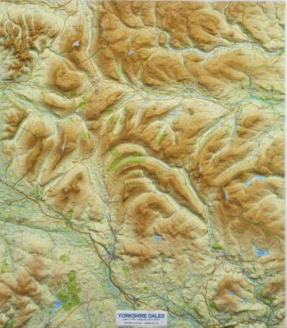
Location
The Dales Trail takes in both the Yorkshire Dales National Park and the Nidderdale Area of Outstanding Natural Beauty (NAONB). Since the National Park was first created in 1954 it has been extended and now covers 2,179 square kilometers to which we can add NAONB with another 600 sq. km.
Today the exact boundaries of the 'Yorkshire Dales' remain fluid. In the popular imagination the Yorkshire Dales centers on Swaledale, Wensleydale and Wharfedale but there are many other Dales with counts varying from 30 to over 50.
To complicate matters the extension of the Yorkshire Dales National Park in 2016 took in areas of Cumbria, traditionally a region with a very separate identity to the Yorkshire Dales.
In broad terms we define the Dales Trail as traversing the area between the Stainmore Gap to the north, Settle to the south, Nidderdale to the east and Ribblesdale to the west.
Dales found within this broad area include:
Apedale, Arkengarthdale, Barbondale, Birkdale, Bishopdale, Claphamdale, Cotterdale,
Coverdale, Crummackdale, Deepdale, Dentdale, Fossdale, Garsdale, Gordale,
Kingsdale, Langdale, Langstrothdale, Littondale, Lonsdale, Lunesdale,
Malhamdale, Mallerstang, Mossdale, Nidderdale, Ravenstonedale, Raydale,
Ribblesdale, Swaledale, Waldendale, Wensleydale, Wharfedale, Widdale.