Summary
Options
A. Ride the trail in a ‘oner’
£15 for 25 year old and under
£30 for 26 year old and above
B. Ride as a self supported bikepacker (includes campsite)
£45 for 13 - 25 year old
£65 for 26 year old and above
C. Ride over two days with luggage transfer of your gear to the campsite is £85
One large bag is best for the luggage transfer but there are no rules.
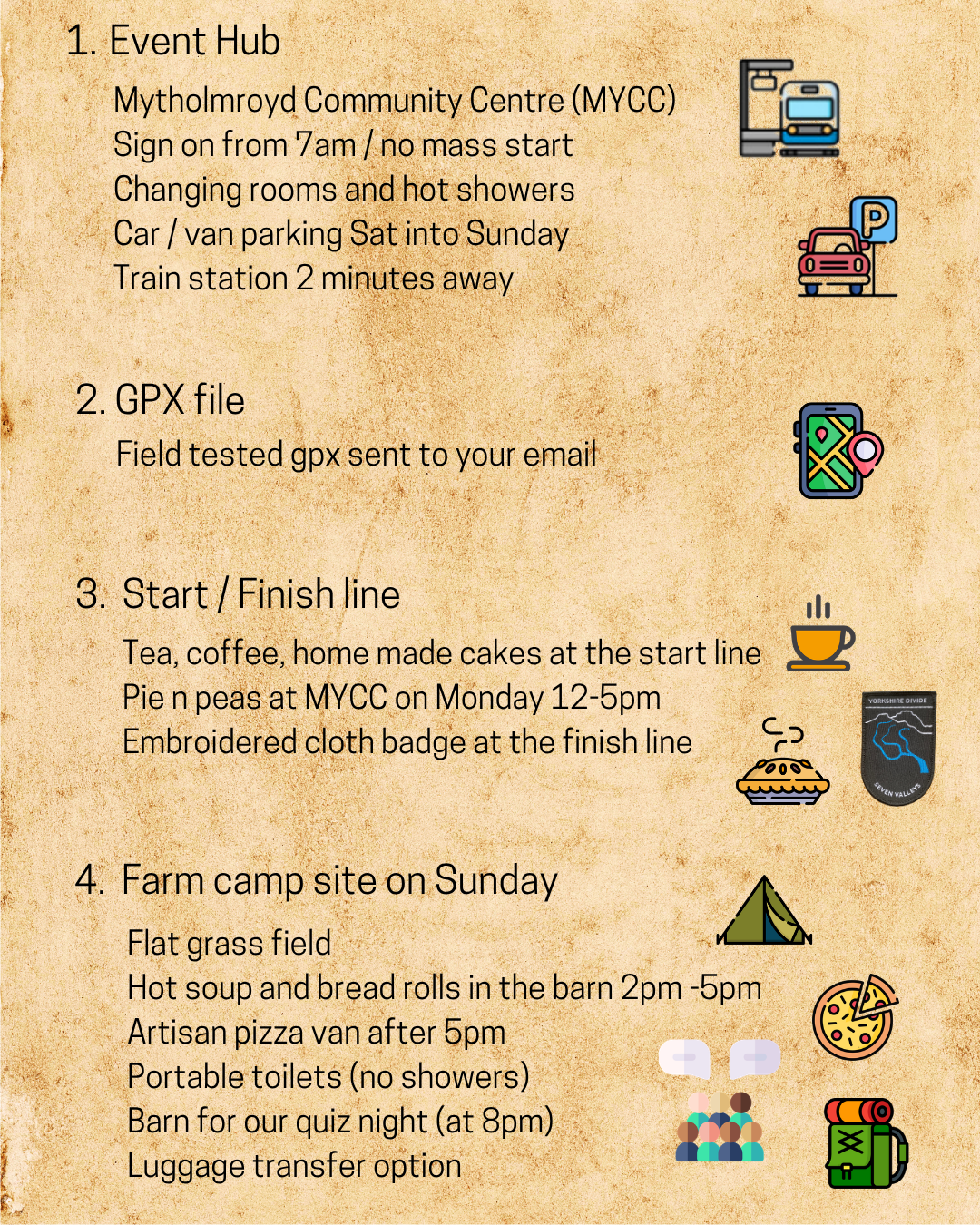
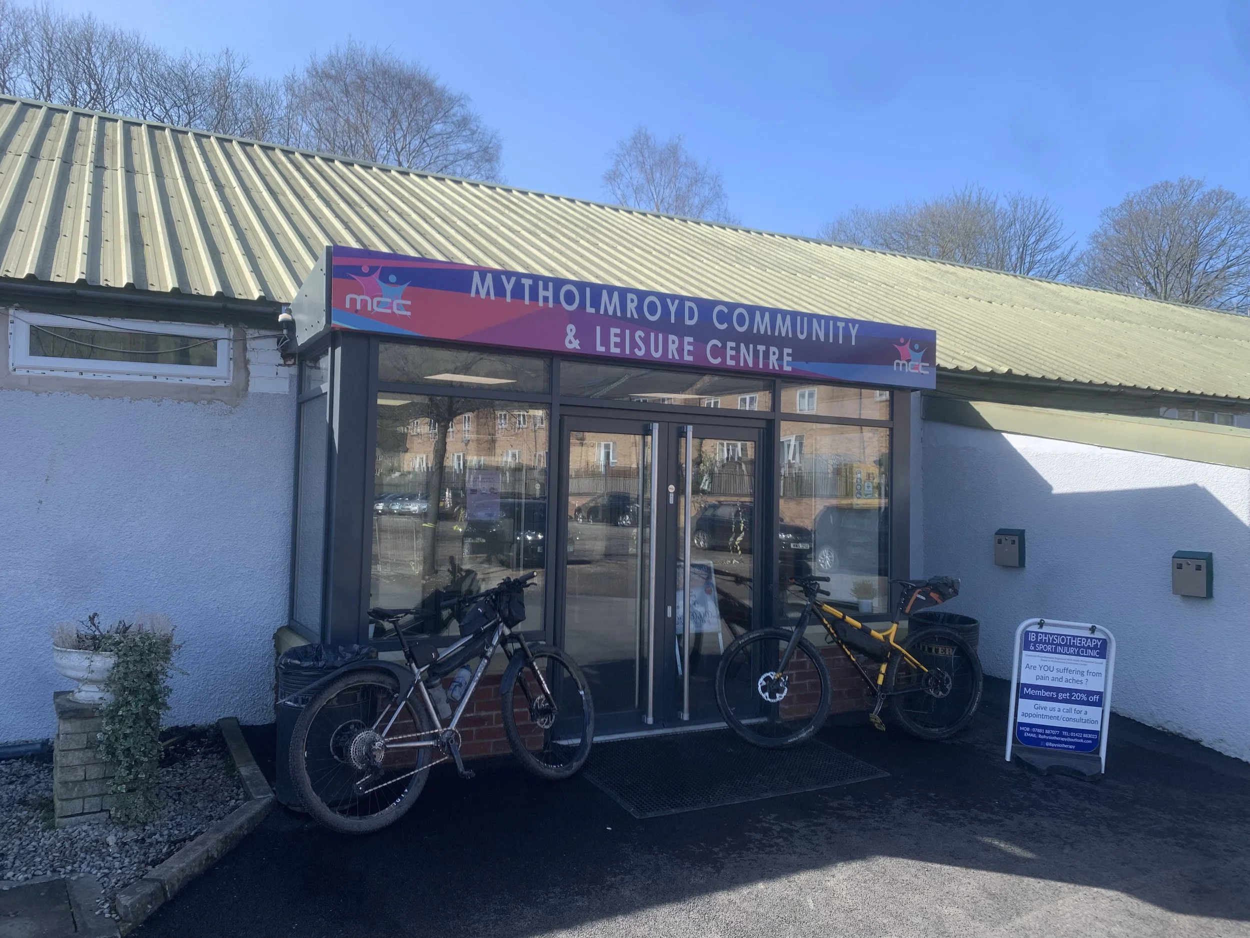
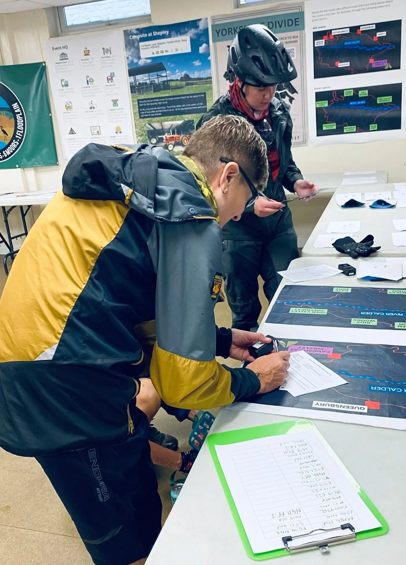
2. Event Hub
Mytholmroyd Community Centre (MYCC) at Caldene Avenue (HX7 5AF) has 100 parking spaces with the parking charge included in your sign on fee. Drivers must record their registration number at the front desk otherwise they will incur a charge from the CP monitoring firm.
Camper vans can park over Saturday and Sunday night.
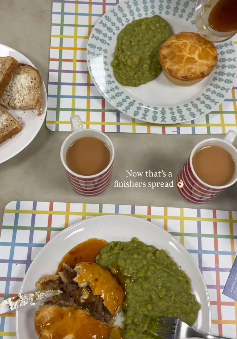
We have use of a large room inside the Centre with a kitchen where we prep Mondays pie n peas.
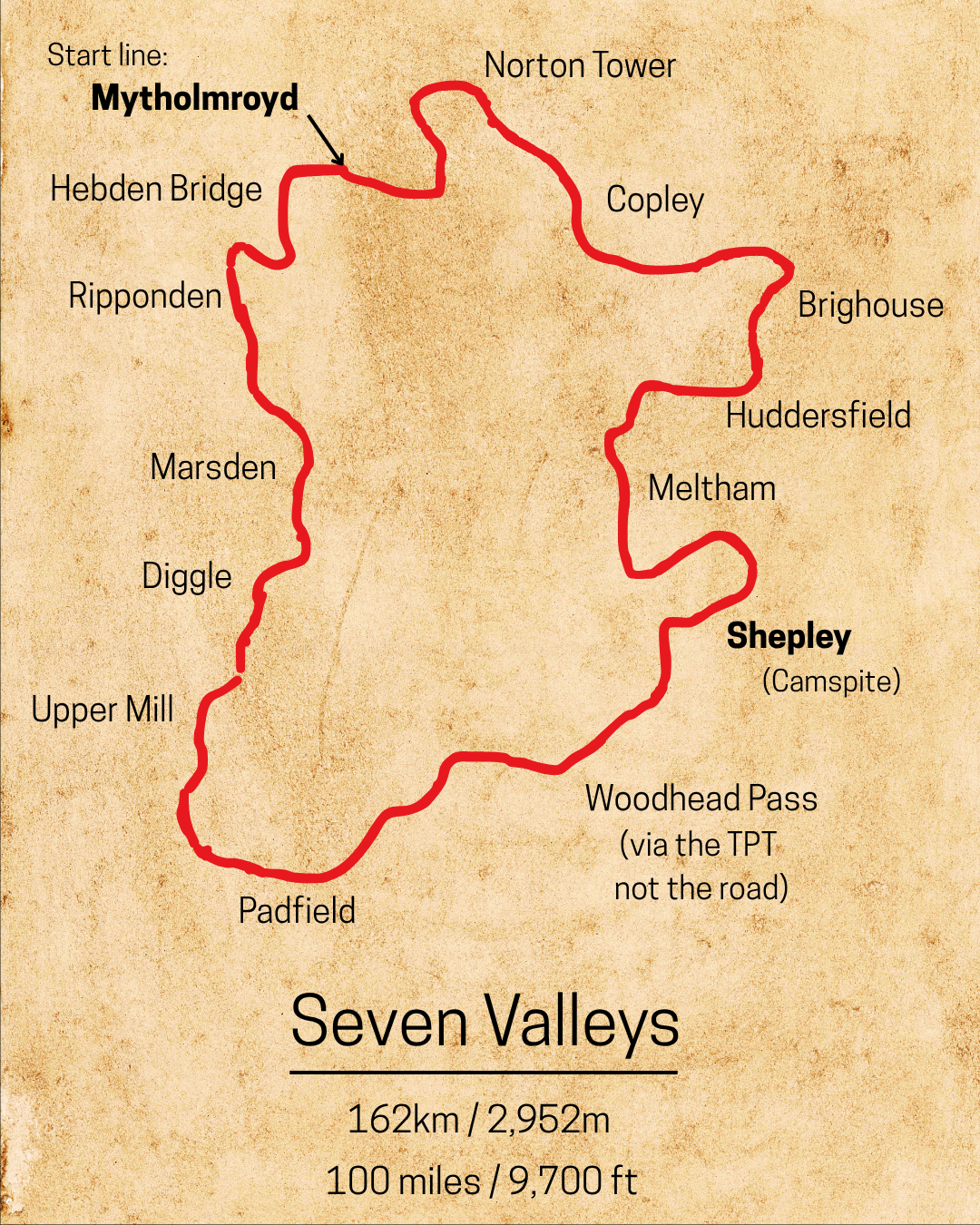
3. Start / Finish line
Register from 7am and ride from 7.15am (no mass start)
4. Campsite + food + pizza van
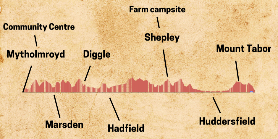
Marsh Farm, which we’ve used on the Calder Divide Trail for a number of years, is the location of our Seven Valleys campsite. One large flat grass field to pitch tents / roll out bivy’s.
The farm is at the edge of a village called Shepley which has a Coop store and TWO pubs.
The farm has a barn where riders can enjoy hot soup and bread rolls on Sunday from 2pm - 5pm and the artisan pizza van from 5pm. There will be a hot drinks DIY serving point as well as tables and chairs. The quiz is in the barn at 8pm.
Bikes are store in the barn. Bring a lock (which can be transported up to and back from the farm so you don’t have to carry it)
On Monday morning from 7am there is porridge, toast and jam served in the barn as well as tea and coffee to help get you stated on the return leg back to Mytholmroyd.
The farm doesn’t have showers for us campers but we do hire in a set of portable toilets with sinks (cold water) and there are hot showers back at the Mytholmroyd Community Centre (finish line).
If you have a camper van or a motor home you would like to stay in on the Sunday night then that’s fine as the farm has a separate field for large vans.
Email Adrian and we’ll arrange a space for you van - yorkshiredivide@gmail.com

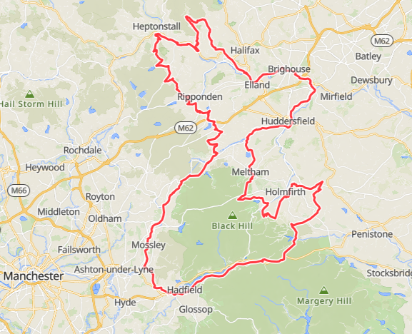
5. The Tracks and Lanes
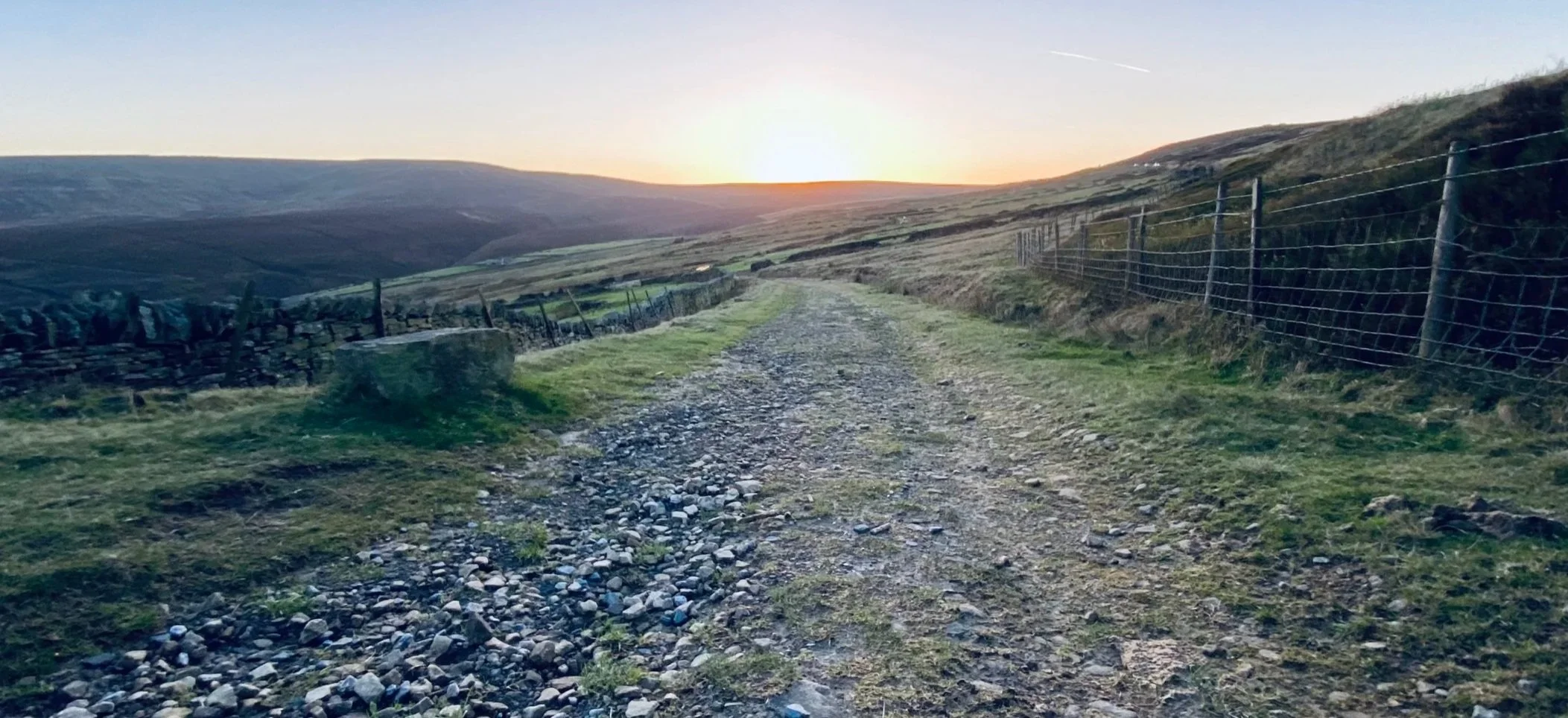
There are tracks on fine crunchy gravel, tough sandstone cobbles, soft peat and smooth tarmac. OK maybe not smooth tarmac as there are potholes, but the off-road tracks are on bridleways and greenways across the South Pennines which are often overlooked as a riding destination but there are many miles of flowing tracks and rewarding climbs that give stunning views of the ever changing landscape. The route is approximately 70% off-road.
6. the Route
The 162km route is best visualized in three parts:
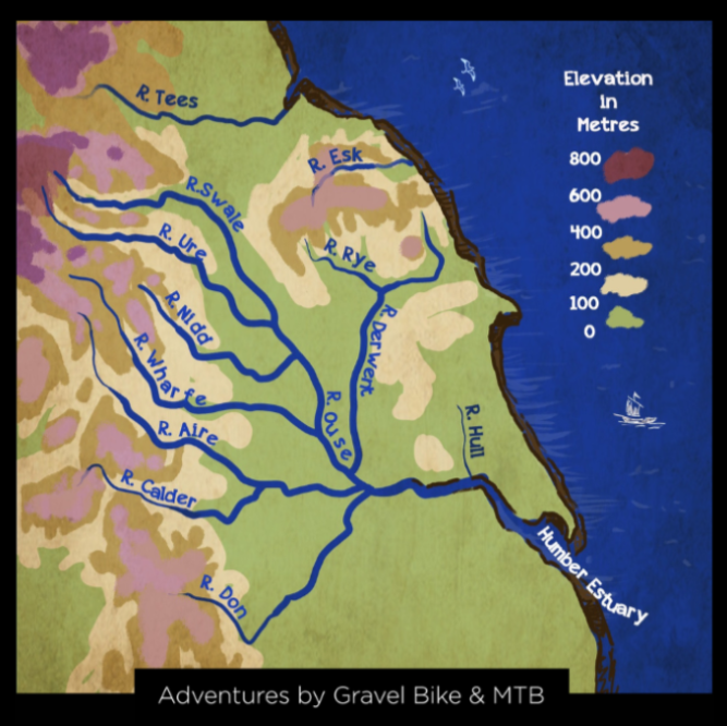
i. Between the start line and the campsite at 88km (55 miles) we cross four of the Seven Valleys - Calder, Ryburn, Tame and Langdendale. These valleys are fairly evenly spaced out so as a rider there is a pattern of steep climb, brief ride on the moorland plateau, then descent.
ii. Between the campsite and the finish line there are three valleys - Colne, Holme and Luddenden - and these are the steepest and so the most rewarding valleys!
iii. The three valleys on your return are not evenly spaced out. The Colne and Holme are two sister valleys nestled together. After the Colne Valley you have a long and flowing section on the valley floor using three different but connected canal towpaths. At first this is the Huddersfield Narrow Canal, then the Huddersfield Broad Canal and finally the Calder and Hebble Navigation. In total you have 24km of easy riding on these canal towpaths (a bell on your handlebars is a good idea) before you get to the final valley which is Luddenden.
7. Your Bike
The route can be completed on a gravel or mountain bike. The route is not suitable for a road bike. If you intend to ride the route on a gravel bike then you would benefit from the widest tyres possible eg 45mm or preferably 50mm.
I have ridden the whole route on my gravel bike and it was a blast though I did have to push up two slopes. I repeated the whole route on my hardtail with 2.3 tyres and 100mm forks. The hardtail, for me, was that little bit more comfortable as 100 miles is a long way. But I still had to push uphill no matter which bike I rode!!
8. E-Bikes
E-MTB’s and E-GRAVEL bikes are welcome. Just remember to park the spare battery and / or recharging cables for the farm on Sunday night.
Please email Adrian - yorkshiredivide@gmail.com - so we can plan ahead with extension leads etc.
9. The GPX
The finalised GPX route file will be sent out to all participants by 19/05/2026 with a link to Ride with GPS.
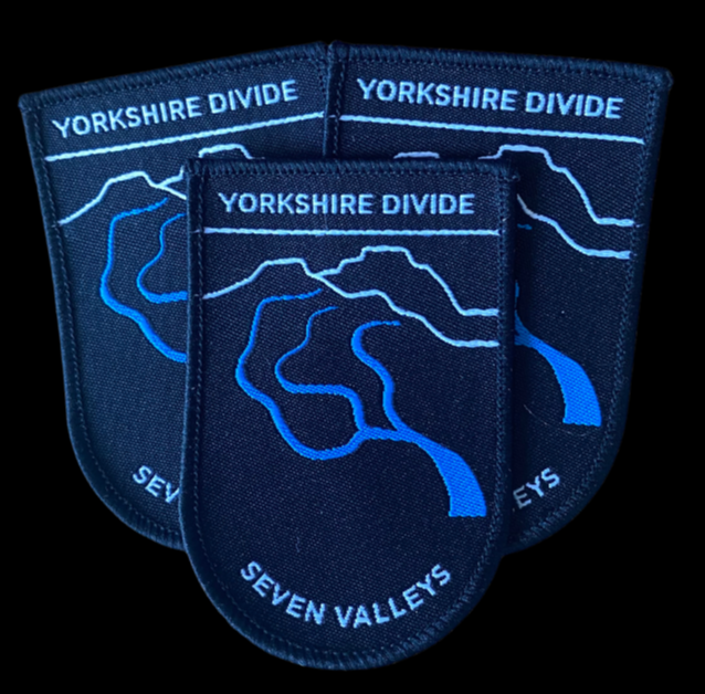
10. The Badge
One day riders
Riders on the ‘oner’ should be aware that the event team is at Mytholmroyd Community Centre on Sunday morning but by midday Sunday and through till early Monday they are up at the campsite in Shepley. Hence there is no flag waving or bell ringing (at least not from the event team) to greet you as you pass the finish line after your epic one day ride and no pie n peas on Sunday. But there will be a badge (in your registration envelope when you sign on) and there are three pubs in Mytholmroyd and more in Hebden Bridge with plenty of eating places to choose from.